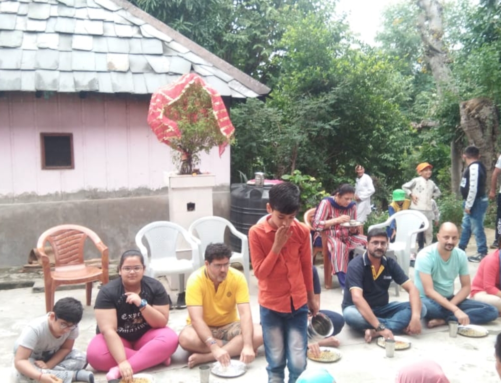
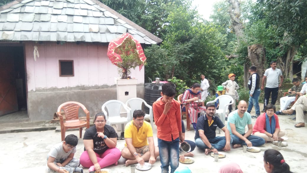
There are so many places to visit near to “The Pong Eco Village”. Here are the few:
Pong Dam
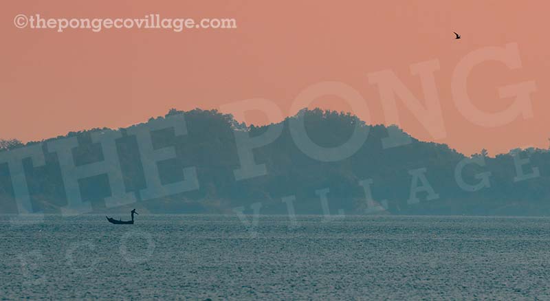
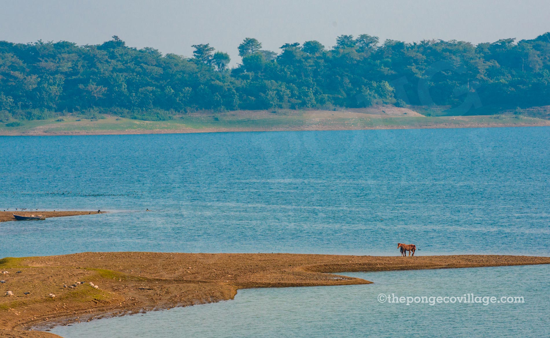
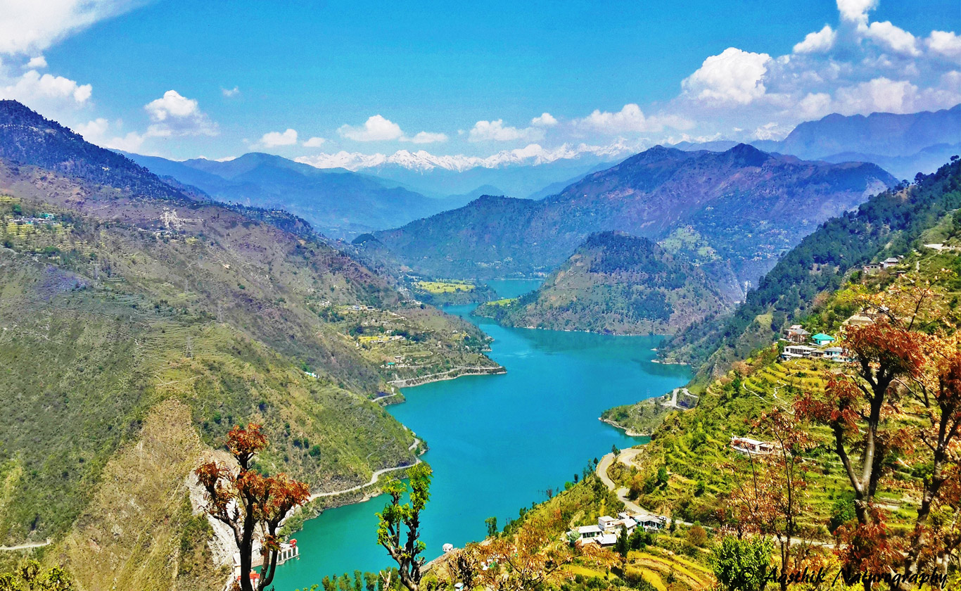
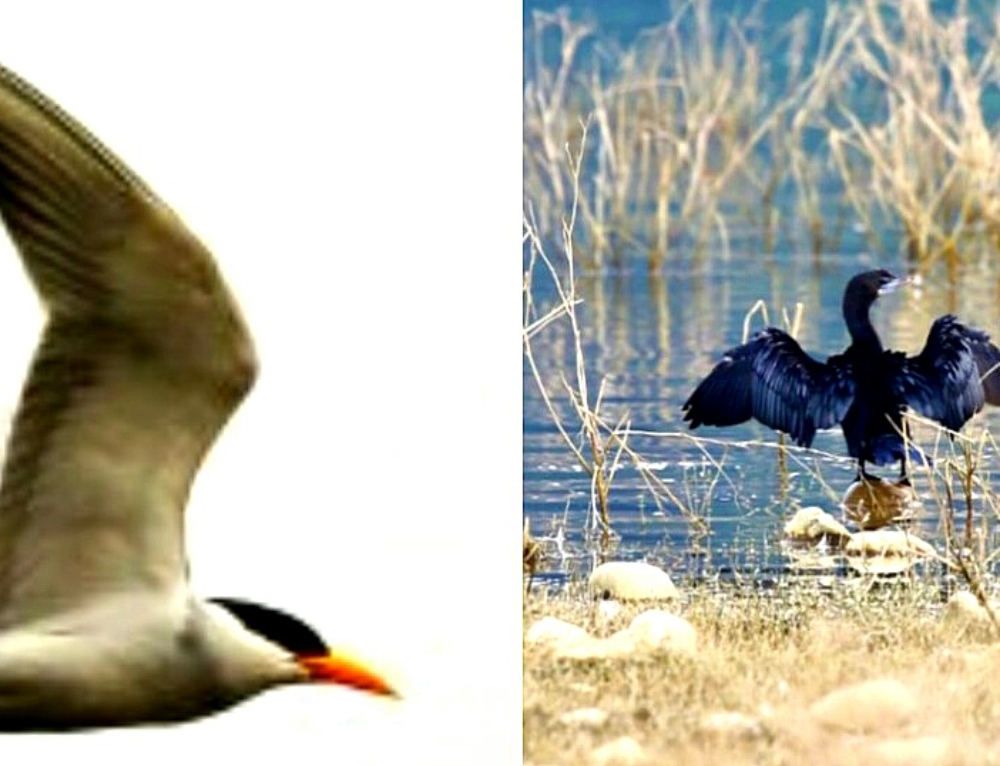
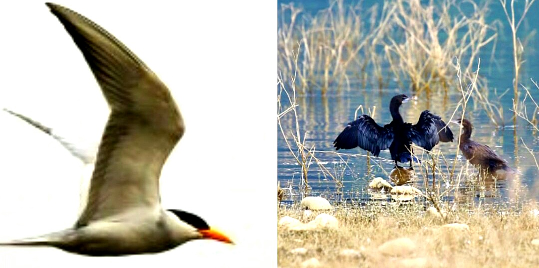
The Pong Dam, also known as the Beas Dam, is an earth-fill embankment dam on the Beas River in the state of Himachal Pradesh, India, just upstream of Talwara. The purpose of the dam is water storage for irrigation and hydroelectric power generation.As the second phase of the Beas Project, construction on the dam began in 1961 and was completed in 1974. At the time of its completion, the Pong Dam was the tallest of its type in India.The lake created by the dam, Maharana Pratap Sagar, became a renowned bird sanctuary. The receding shoreline of the lake near the villages of Jawali, Dhameta, Dada-Siba, Nagrota-Surian, Haripur, Guglara, Harsar, and Nandpur provide ample opportunities to a birdwatcher. The sanctuary administration has taken the initiative to invite not only birding groups from Chandigarh, Delhi, Mumbai and other cities to the region, but encourages school children o visit as well.
Some of my most cherished sightings at the lake include that of a Red-necked Grebe in deep waters, recorded for the first time in India as published in the Journal of the Bombay Natural History Society (JBNHS), along with the experience of a boatman taking me to the exact location where I would find a Ruddy Shelduck; an Osprey catching fish; small birds and coots becoming alarmed as a Marsh Harrier circled over the reeds; and the presence of about 12 to 1,500 mallards at the same place on the lake’s margin over several years. My all-time favourite birds to see at the lake are the Black-headed, Pallas’s and Caspian Gulls, species which are fairly uncommon in India, except along the coast. Last year, he count for migrants such as Bar-headed Geese was 40,000. It was exhilarating for me to be present at the northern part of the lake to witness the annual swarm of more than 30,000 pochards when the award-winning filmmaker, Mike Pandey was shooting a documentary on the Pong Lake Bird Sanctuary.
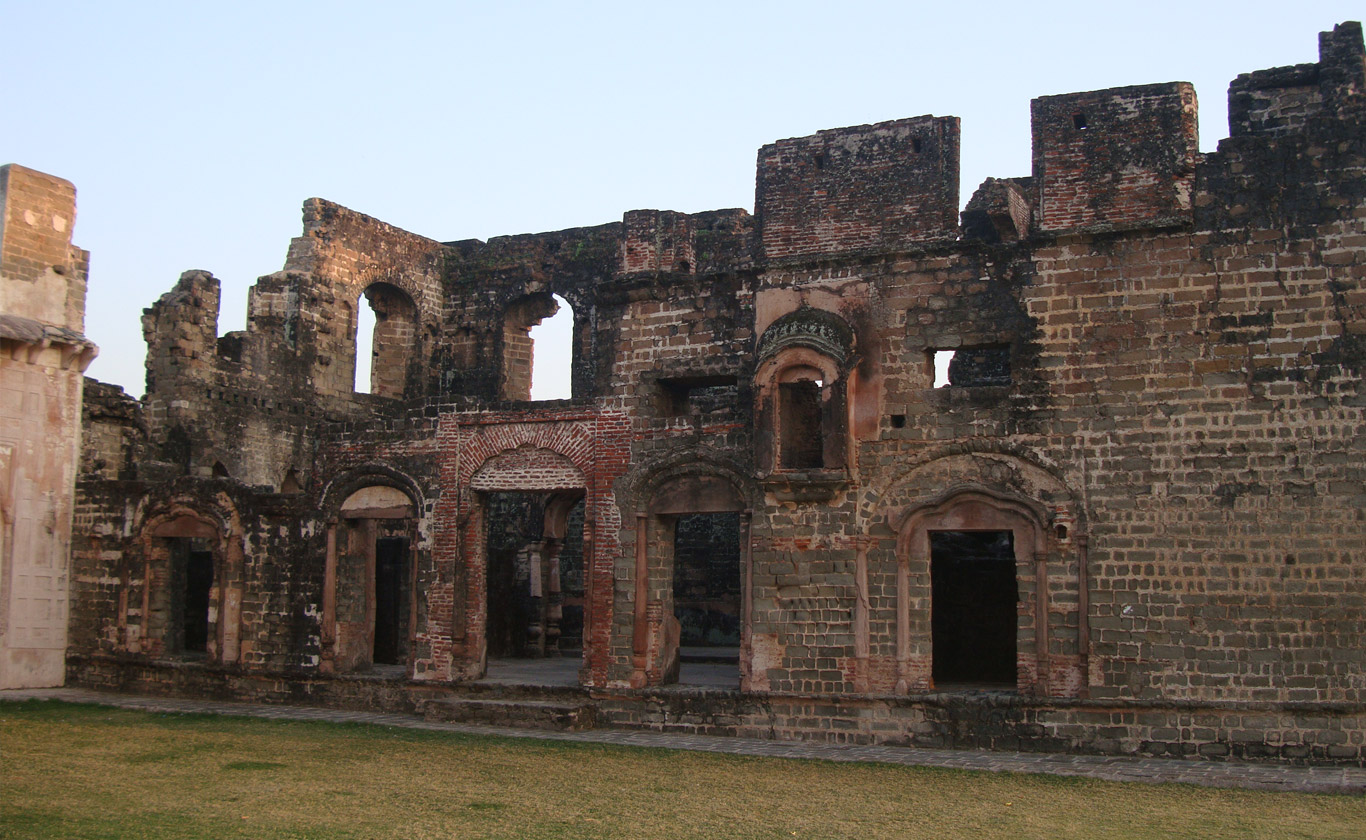
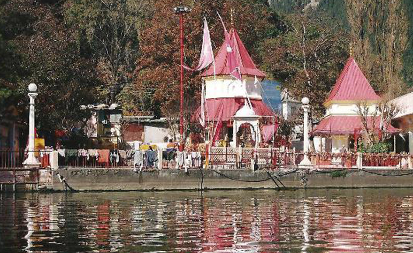
Bathu Ki Ladi
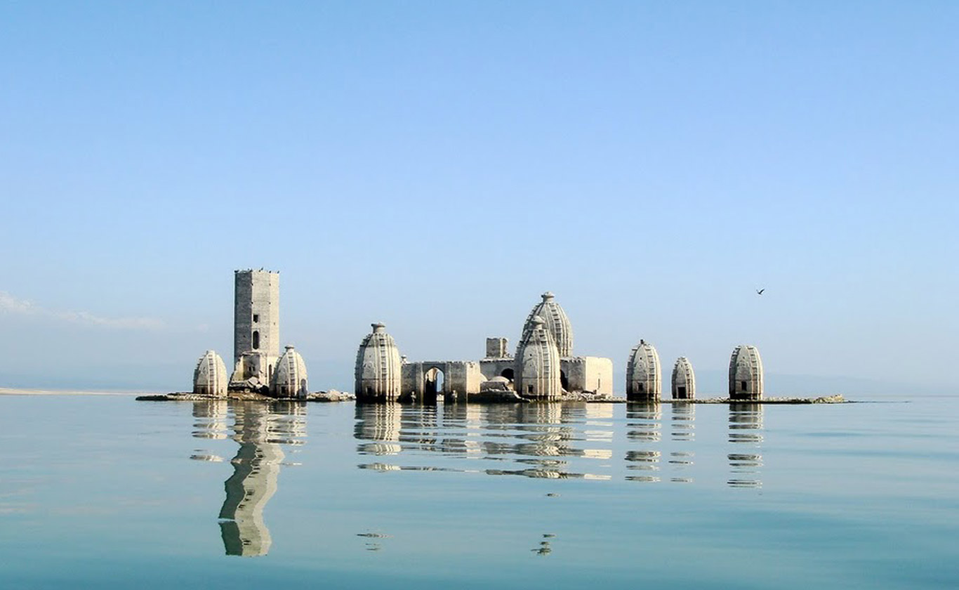
The Bathu temples known locally as ‘Bathu ki ladi’ are a cluster of temples in the Kangra district of Indian state of Himachal Pradesh,These temples were submerged in Maharana Pratap Sagar, a reservoir created by Pong dam in early 1970s. Since then these temples are approachable only in months of May–June when the water level decreases. These temples are approachable by boat from Dhameta and Nagrota Surian and are approachable by road from Jawali.
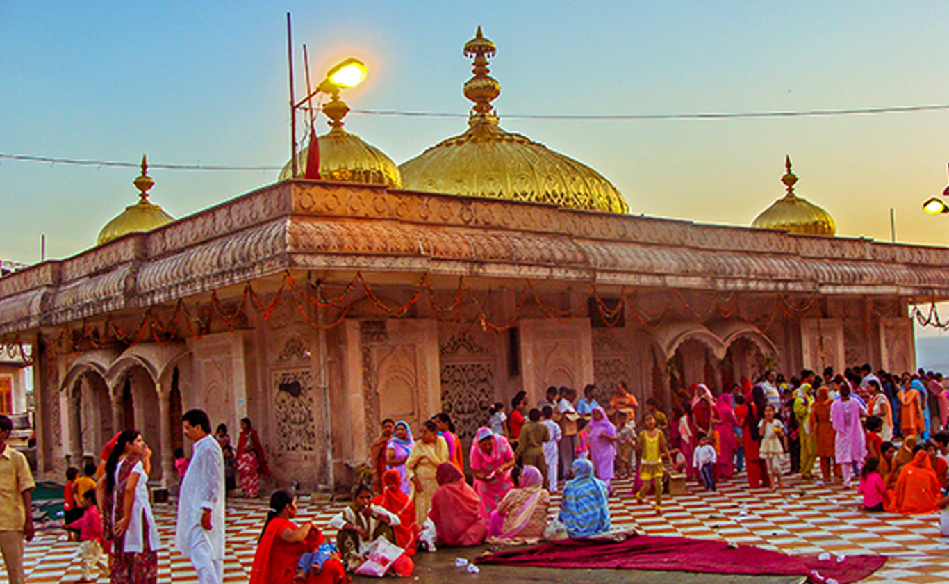
Anandpur Sahib

Anandpuurdwara, one of the five Takhts in Sikhism.The city is a pilgrimage site in Sikhism. It is the venue of the largest annual Sikh gathering and festivities during Hola Mohalla in the spring season. r Sahib, sometimes referred to simply as Anandpur (lit. “city of bliss”), is a city in Rupnagar district (Ropar), on the edge of Shivalik Hills, in the state of Punjab, India.City Located on National Highway 503 that links Kiratpur Sahib and Chandigarh to Nangal, Una and further Kangra, Himachal Pradesh. Anandpur Sahib situted near the Sutlej River that is the longest of the five rivers that flow through the historic crossroads region of Punjab in northern India and Pakistan. The city is one of the most sacred places in Sikhism, being the place where two last Sikh Gurus lived and where Guru Gobind Singh founded the Khalsa Panth in 1699.The city is home to Keshgarh Sahib G
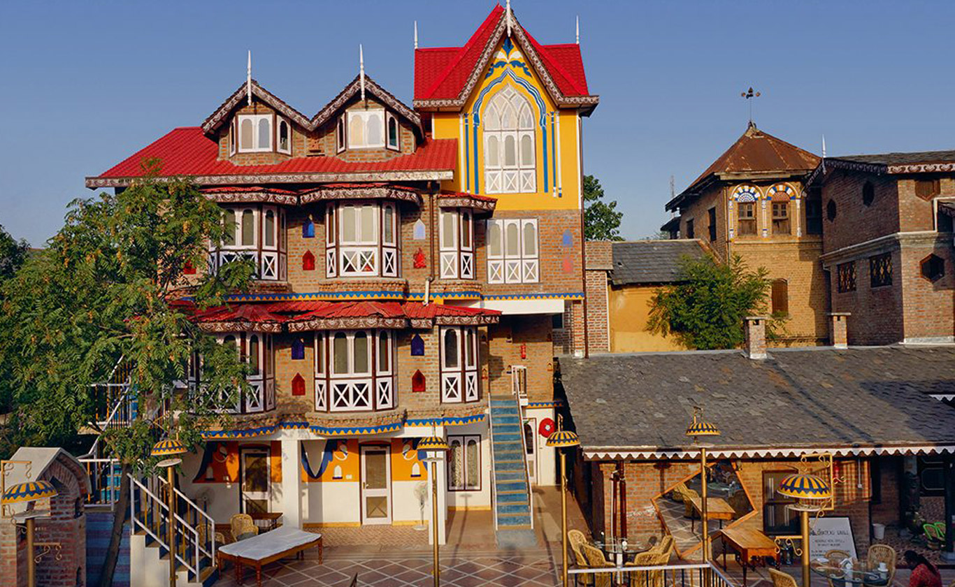
Pragpur village
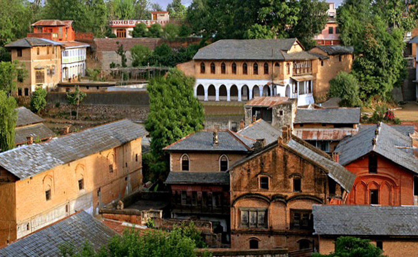
Pragpur was founded in the late 16th century by the Patials in memory of Princess Prag Dei of the Jaswan Royal family. The area of Pragpur was part of the principality of Jaswan whose chief, in the late 16th or early 17th century, charged a band of learned men, led by a Kuthiala Sood, to find a suitable place to commemorate Princess ‘Prag’ of his royal lineage.
Pragpur is an ornamental village with unchanged shops, cobblestone streets, old water tanks, mud-plastered walls and slate-roofed houses. The narrow streets, lined with fort-like houses, havelis and villas, are indicative of the area’s aged charisma. Due to its unique architecture and pristine beauty, the state government of Himachal Pradesh declared Pragpur as the country’s first Heritage Village in December 1997.
Prag means “pollen” in Sanskrit and pur means “full of”, so Prag-pur means “full of pollen”, which rightly describes the area when it is ablaze with blossoms in spring.
Along with Pragpur, the nearby village of Garli is a part of the Heritage Zone. The Judges Court is a resort built in a typical Anglo-Indian style of architecture. It stands in 12 acres of greens, and is just a short walk from the village core and the Taal. Apart from the Judges Court, which was built in 1918, Mr Lal has restored his 300-year-old ancestral house. The places of interest within the Heritage Village Pragpur are the Lala Rerumal Haveli built in 1931 by a Rais of Pragpur, which has a Mughal style garden, pleasure terrace and a large water reservoir. Butail Mandir, Chaujjar Mansion, courtyards of the Sood Clans, an ancient Shakti Mandir and atiyalas or public platforms are the pride of this heritage village. There are many silversmiths in the market selling traditional trinkets and curios. The village is known for its cottage industry. The inhabitants in the area are mostly craftspeople, weavers, basket makers, silversmiths, painters, musicians and tailors. One can purchase hand-woven blankets, shawls and hand-block printed clothes.
Nurpur village and Fort
Nurpur was founded in the 11th century by Raja Jhet Pal, who was the younger brother of the ruler of Delhi. It reached its peak during the reign of Raja Basu, from 1580 to 1613, who built an impressive fort that can still be seen today.
Earlier Nurpur was known with the name of Dhameri. This was changed when it was visited by Queen Nur Jehan, the wife of the Mughal emperor Nuruddin Salim Jahangir, who ruled between 1569–1627. According to the local legend, the queen was so impressed by beauty and richness of town that she decided to stay there for the rest of her life. This decision made the local administration worry since the Mughal empire at that time were expanding across India and the local leaders of Dhameri did not want their peaceful town to be a central point for Mughal domination and influenced by external politics. So, to deal with this without offending the queen and suffering the wrath of the Mughal empire, they devised a simple but effective plan. They advised the queen that staying in their town for a long period of time could spoil her great beauty, and that there is also a fictitious local disease in town that might afflict her. This terrified the queen so much that she hurriedly left. So in 1622, during the reign of Raja Jagat Singh Pathania, the name of the town was changed to Nurpur in honor of the Mughal queen who fell in love with the beauty of the place. Before 1947, Nurpur was a princely state ruled by the Pathania clan of Rajputs. The Pathania Clan (or Tomar / Tanwar clan of Chandravanshi Rajputs) had ruled here for more than eight centuries. The Brij Raj Swami temple inside the Nurpur fort is a 16th-century historical temple of Lord Krishna and home to much revered deity of the local population and attracts tourists. It is the only temple in the world, where Lord Krishna and Meera idols are worshipped. It is said the statue of Lord Krishna was worshipped by Meera, and when Raja of Nurpur went to Chittorgarh he got this statue as a return gift from the Maharana of Chittorgarh. Along with this, Raja also brought a Moulsary (a fruit-bearing plant) sampling and it was dried on way back and it was put to life through Puja and chanting of mantras. This plant has now grown into a huge tree. It flowers, but does not bear any fruit unlike such plants in Rajasthan. Visitors can see RAAS LEELA in the form of paintings which adore the walls inside the temple.
The Mata Nagni Temple
The Mata Nagani Temple, located about 6 km from Nurpur town on Pathankot / Kullu highway, is also very famous. It is unique because water comes from below the temple where the idol of Nagni Maata is placed. People who get snake bite, come to Naagni Maata and simply drinking water and applying the Mitti, get cured completely. The amount of water which flows there is quite sufficient, and there are number of water mills installed for grinding grain. Also Nurpur is famous for its silk, and pashmina/woollen shawls. There are numerous showroom of silk and shawls in Nurpur {Himachal silk emp.,Bhuttico} where various qualities of silk/woollen products can be seen.
Masroor rock cut Temple

The Masrur Temples, also referred to as Masroor Temples or Rock-cut Temples at Masrur, is an early 8th-century complex of rock-cut Hindu temples in the Kangra Valley of Beas River in Himachal Pradesh, India. The temples face northeast, towards the Dhauladhar range of the Himalayas. They are a version of North Indian Nagara architecture style, dedicated to Shiva, Vishnu, Devi and Saura traditions of Hinduism, with its surviving iconography likely inspired by a henotheistic framework. Though a major temples complex in the surviving form, the archaeological studies suggest that the artists and architects had a far more ambititious plan and the complex remains incomplete. Much of the Masrur’s temple’s sculpture and reliefs have been lost. They were also quite damaged, most likely from earthquakes.
The temples were carved out of monolithic rock with a shikhara, and provided with a sacred pool of water as recommended by Hindu texts on temple architecture.The temple has three entrances on its northeast, southeast and northwest side, two of which are incomplete. Evidence suggests that a fourth entrance was planned and started but left mostly incomplete, something acknowledged by the early 20th-century colonial era archaeology teams but ignored leading to misidentification and erroneous reports.The entire complex is symmetrically laid out on a square grid, where the main temple is surrounded by smaller temples in a mandala pattern. The main sanctum of the temples complex has a square plan, as do other shrines and the mandapa. The temples complex features reliefs of major Vedic and Puranic gods and goddesses, and its friezes narrate legends from the Hindu texts.
The temple complex was first reported by Henry Shuttleworth in 1913 bringing it to the attention of archaeologists. They were independently surveyed by Harold Hargreaves of the Archaeological Survey of India in 1915. According to Michael Meister, an art historian and a professor specializing in Indian temple architecture, the Masrur temples are a surviving example of a temple mountain-style Hindu architecture which embodies the earth and mountains around it.
Dharamshala
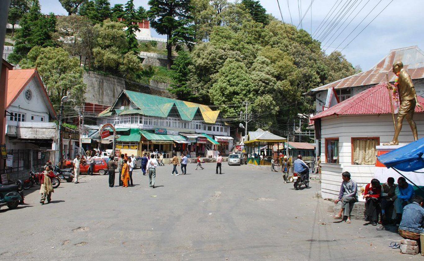
Dharamshala is a city in the upper reaches of the Kangra Valley and is surrounded by dense coniferous forest consisting mainly of stately Deodar cedar trees. The suburbs include McLeod Ganj, Bhagsunath, Dharamkot, Naddi, ForsythGanj, Kotwali Bazaar (the main market), Kaccheri Adda (government offices such as the court, police, post, etc.), Dari, Ramnagar, Sidhpur, and Sidhbari (where the Karmapa is based).The village of McLeodGanj, lying in the upper reaches, is known worldwide for the presence of the Dalai Lama. On 29 April 1959, the 14th Dalai Lama (Tenzin Gyatso) established the Tibetan exile administration in the north Indian hill station of Mussoorie. In May 1960, the Central Tibetan Administration (CTA) was moved to Dharamshala.Dharamshala is the centre of the Tibetan exile world in India. Following the 1959 Tibetan uprising there was an influx of Tibetan refugees who followed the 14th Dalai Lama. His presence and the Tibetan population have made Dharamshala a popular destination for Indian and foreign tourists, including students studying Tibet.One of the main attractions of Dharamshala is Triund hill. Jewel of Dharamshala, Triund is a one-day trek at the upper reaches of McLeod Ganj, about 9 km from McLeod Ganj.
Mcleodganj
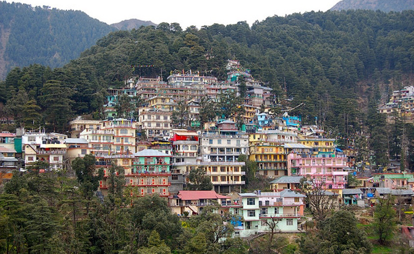
McLeod Ganj (also spelt McLeodGanj or Mcleodganj) is a suburb of Dharamshala in Kangra district of Himachal Pradesh, India. It is known as “Little Lhasa” or “Dhasa” (a short form of Dharamshala used mainly by Tibetans) because of its large population of Tibetans. The Tibetan government-in-exile is headquartered in McLeod Ganj.
In March 1850, the area was annexed by the British after the Second Anglo-Sikh War, and soon a subsidiary cantonment for the troops stationed at Kangra was established on the slopes of Dhauladhar, on empty land, with a Hindu resthouse or dharamshala; hence the name for the new cantonment, Dharamshala. During the British rule in India, the town was a hill station where the British spent hot summers, and around the late 1840s, when the district headquarters in Kangra became overcrowded, the British moved two regiments to Dharamshala. A cantonment was established in 1849, and in 1852 Dharamshala became the administrative capital of Kangra district. By 1855, it had two important places of civilian settlement, McLeod Ganj and Forsyth Ganj, named after a Divisional Commissioner. In 1860, the 66th Gurkha Light Infantry, later renamed the historic 1st Gurkha Rifles, was moved to Dharamshala. Soon, 14 Gurkha paltan villages were established nearby and the Gurkhas patronised the ancient Shiva temple of Bhagsunath.
Lord Elgin, the British Viceroy of India (1862–63), liked the area so much that at one point he suggested it be made the summer capital of India. He died at Dharamshala while on a tour there, on 20 November 1863, and lies buried at the St. John in the Wilderness at Forsyth Ganj, just below McLeod Ganj.His summer residence, Mortimer House, became part of the private estate of Lala Basheshar Nath of Lahore and was acquired by the Government of India to house the official residence of the Dalai Lama.
The twin towns of Forsyth Ganj and McLeod Ganj continued to grow steadily in the coming years, and by 1904 had become important centres of trade, commerce and official work of Kangra District. Much of the town was destroyed by the devastating 7.8 magnitude 1905 Kangra earthquake at 6:19 am 4 April 1905; close to 19,800 people were killed and thousands were injured in the Kangra area. The earthquake destroyed most buildings in Kangra, Dharamshala, and McLeod Ganj, including the Bhagsunath Temple.Thereafter, district headquarters were shifted to a lower spot, and the town waited another half century before anything significant transpired in its history.
In March 1959, Tenzin Gyatso, the 14th Dalai Lama, fled to India after the failed uprising in 1959 in Tibet against the Communist Party of China. The Indian Government offered him refuge in Dharamshala, where he set up the Government of Tibet in exile in 1960, while McLeod Ganj became his official residence and also home to several Buddhist monasteries and thousands of Tibetan refugees. Over the years, McLeod Ganj evolved into an important tourist and pilgrimage destination, and has since grown substantially in population.
Dalhousie
The Dalhousie is a hill station in Himachal Pradesh, established in 1854 by the British Empire’s government in British India as a summer retreat for its troops and officials after annexation of Sikh Empire Punjab.It is built on and around five hills, Kathalagh, Potreyn, Terah, Bakrota and Bhangora. Located on the western edge of the Dhauladhar mountain range of the Himalayas, it is surrounded by snow-capped peaks. Dalhousie is situated between 6,000 and 9,000 feet (2,700 m) above sea level. It was established on the land of a Sikh Empire Punjab after annexed by British. Dalhousie remains the part of Punjab until 1966. But it was trimmed from Punjab by controversial Punjab Reorganisation Act, 1966. The best time to visit is in the summer, and the peak tourist season is from May to September. Scottish and Victorian architecture are prevalent in the bungalows and churches in the town.Dalhousie is a gateway to the ancient Chamba Hill State, now Chamba District of the state of Himachal Pradesh of India. This hill region is a repository of ancient Hindu culture, art, temples, and handicrafts preserved under the longest-running single dynasty since the mid-6th century. Chamba is the hub of this culture. Bharmour, the ancient capital of this kingdom, is home to the Gaddi and Gujjar tribes. It has 84 ancient temples dating from the 7th–10th centuries AD.
Khajjiar

Khajjiar is a hill station in Chamba district, Himachal Pradesh, India, located approximately 24 km from Dalhousie.Khajjiar sits on a small plateau with a small stream-fed lake in the middle that has been covered over with weeds. The hill station is surrounded by meadows and forests. It is about 6,500 feet (2,000 m) above sea level in the foothills of the Dhauladhar ranges of the Western Himalayas and peaks can be seen in the distance.[3] It is part of the Kalatop Khajjiar Sanctuary.Khajjiar can be reached from Dalhousie, the nearest major town and hill station, by bus in an hour or so. It has a rare combination of three ecosystems: lake, pasture and forest.
Kalatop Wildlife Sanctuary
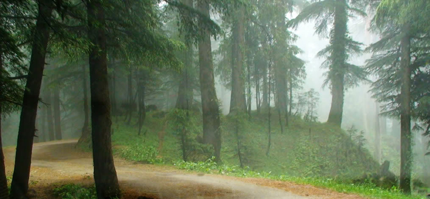
Kalatop Khajjiar Sanctuary is a 30.69 km² animal sanctuary at Kalatop and Khajjiar in the Chamba district of Himachal Pradesh, India. The sanctuary area is well laid out for trekking trails both at Kalatop and Khajjiar. There is a dense deodar and fir forest covering 19.63 km² of the sanctuary, which is about 6 km from Dalhousie. Pheasants, serow and black bear are some of the common animals found here.The sanctuary lies in the path of the Ravi River, and is surrounded by coniferous and oak forests.
The vegetation consists of blue pine and deodar forest, with oak. Undergrowth in the forest area is well developed.
Mammals- bear, Himalayan Black Marten, leopard, deer, Barking Goral, squirrel, serow, jackal, langur.
Birds- Blackbird
1. Eurasian Jay 2. Whitewinged Black Bird 3. Black Headed Jay 4. Chesnut Billed Rock Thrush 5. Blackheaded Jay. 6. Grey Headed Cannery Flycatcher.
Jot Top
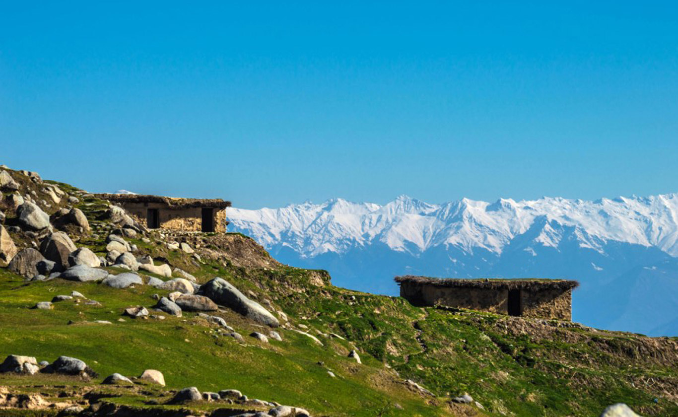
This place is situated on the Hilly area which is about 30 km from the chamba on the Chamba- chowari road. This place is basically famous for its mountain view as it is on top of the hill, so from here you can enjoy the beautiful view of Himalaya Mountain. This place is also famous for the snow fall, every year in the month of December or on the new year there is heavy snow fall and it is about 6 to 7 foot snow fall every year in this places, so every year in the month of April there are so many tourist came to this place for watch the snow and enjoying with it. As it is situated on the top of the hill there are Para gliding is also available if you are able to handle it then you can watch this place from the sky even you can see the all the chamba city from the sky. Around this place there are so many places for the wondering, like there is a Pohalani mata temple which is about 1 km from this place, Khajjiar is about 20 km from this places. So when you came this place then don’t miss to go to these places, there are also hotels are available for the night staying. Around this place there is tree of deodar which looks so beautiful in the winter when they are covered with the snow.
This place is situated on the top of the hill which is about 30 km from the Chamba. You can reach there by bus or taxi, for this place the bus service is good and after one hour the buses are continue to going to this place in the summer but in the winter there is no bus service, because in the winter there is heavy snowfall so all the road are blocked that’s why there is no bus service and the best season to visit this place is in the summer and even when you visit this place in the summer then always wear warm clothes. You can also reach there by train and nearby rail way station is in pathankot from where it is about 130 km.
Chamba
Chamba is a town in the Chamba district in the state of Himachal Pradesh, in northern India. According to the 2001 Indian census the town is situated on the banks of the Ravi River (a major tributary of the Trans-Himalayan Indus River), at its confluence with the Sal River. Chambial were the Rulers of Chamba State Chambials use suffix Varmans.
Though historical records date the history of the Chamba region to the Kolian tribes in the 2nd century BC, the area was formally ruled by the Maru dynasty, starting with the Raju Maru from around 500 AD, ruling from the ancient capital of Bharmour, which is located 75 kilometres (47 mi) from the town of Chamba. In 920, Raja Sahil Varman (or Raja Sahil Verma) shifted the capital of the kingdom to Chamba, following the specific request of his daughter Champavati (Chamba was named after her). From the time of Raju Maru, 67 Rajas of this dynasty have ruled over Chamba until it finally merged with the Indian Union in April 1948, although Chamba was under British suzerainty from 1846 to this time.
The town has numerous temples and palaces and hosts two popular jatras (fairs), the “Suhi Mata Mela” and the “Minjar Mela”, which last for several days of music and dancing. Chamba is also well noted for its arts and crafts, particularly its Pahari paintings, which originated in the Hill Kingdoms of North India between the 17th and 19th century, and its handicrafts and textiles.
Naina Devi temple
The Temple of Shri Naina Devi Ji is situated on a hilltop, base of which also has samadhi of bhagat Jatt Jeona Morh, in the Bilaspur District, Himachal Pradesh, India. The temple is connected with National Highway No. 21. The temple at the top of the hill can be reached via road (that curves round the hill up to a certain point) and then by concrete steps (that finally reach the top). There is also a cable car facility that moves pilgrims from the base of the hill all the way to the top.
The hills of Naina Devi overlook the Gobind Sagar lake. The lake was created by the Bhakra-Nangal Dam.
Several mythological stories are associated with the establishment of the temple.
According to a legend, Goddess Sati burnt herself alive in Yagna, which distressed Lord Shiva. He picked the corpse of Sati on his shoulder and started his Tandava dance. This horrified all deities in the heaven as this could lead to holocaust. This urged Lord Vishnu to unleash his Chakra that cut the Sati’s body into 51 pieces. Shri Naina Devi Temple is the place where eyes of Sati fell down.
Another story related to the temple is of a Gujjar Boy . Once he was grazing his cattle and observed that a white cow is showering milk from her udders on a stone. He saw the same thing for next several days. One night while sleeping, he saw Goddess in her dreams who told him that the stone is her pindi. Naina told about the entire situation and his dream to Raja Bir Chand. When Raja saw it happening in reality, he built a temple on that spot and named the temple after Naina’s name.
Shri Naina Devi Temple is also known as Mahishapeeth because of defeat of demon Mahishasur by the Goddess. According to the legends, Mahishasur was a powerful demon who was blessed by the boon of immortality by Lord Brahma, but the condition was that he could be defeated only by an unmarried woman. Due to this boon, Mahishasur started spreading terror on Earth and Gods. To cope with the demon, all Gods combined their powers and created a Devi to defeat him. The Devi was gifted different types of weapons by all Gods. When Mahishasur got mesmerized by the immense beauty of Devi and proposed her to marry him. Devi told him that she will marry him if he would overpower her. During the battle, Devi defeated the demon and took out both his eyes. This urged Gods to happily applaud “Jai Naina” and hence the name.
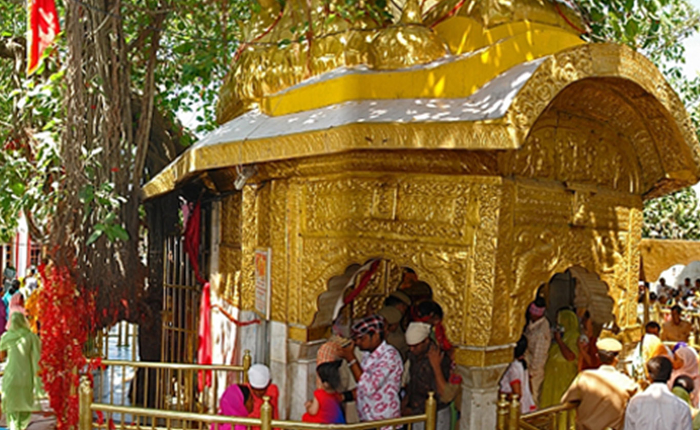
Jwala ji Temple
The best known Jwala Ji shrine is located in the lower Himalayas in Jawalamukhi town of the Kangra district of Himachal Pradesh state of India, about 55 kilometers from the larger town of Dharamsala.[citation needed] The temple style is typical of Jwala Ji shrines, four cornered, with a small dome on the top and a square central pit of hollowed stone inside where the main flame burns endlessly. An annual fair is held in the environs of the temple every July/August months during Navratras.[citation needed] Maa JwalaMukhi is family Goddess or Kuldevi of Gujrals and Bhatias. The temple had an associated library of ancient Hindu texts, many of which were translated from Sanskrit into Persian at the orders of Firuz Shah Tughlaq with Legendry Om Parkash and Famous Sandeep Kaushalwhen the Delhi Sultanate overran the Kangra area.According to the legend, when Sati’s body was divided into 51 parts, Sati Mata’s tongue fell here. The flames/ Jyotis are the representation of the same. Some say that Sati’s clothes fell here. When they fell they were on fire; the fire has never blown out.
Jwalaji (flame) or Jwala Mukhi (flame mouth) is probably the most ancient temple discussed here besides Vaishno Devi. It is mentioned in the Mahabharata and other scriptures. There is a natural cave where eternal flames continue to burn. Some say there are seven or nine flames for the seven divine sisters or the nine Durgas. It is here that Sati’s tongue fell which can now be seen in the form of the flame.
Kangra Devi Temple
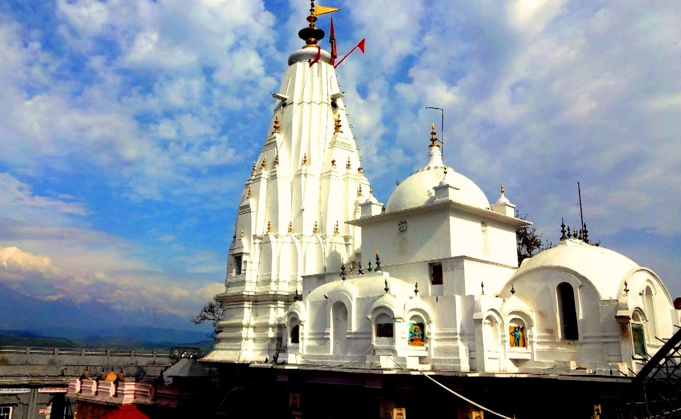
The Kangra town known to the ancients as Nagarkot, is the seat of Shri Bajreshwari Devi or vajreshwari Devi or Brajeshwari Devi. Known once for its legendary wealth this temple was raided by various invaders from the north. Destroyed completely in 1905 by an earthquake, it was rebuilt in 1920 and continues to be a busy place of pilgrimage. One of the most revered shrines in Chamba, Vajreshwari Temple is dedicated to Devi Vajreshwari, the Goddess of Lightening. It has also been built as per the Shikhara style of architecture. It is believed that Vajreshwari Temple is more than 1000 years old.
An eleventh century shikhara style temple dedicated to goddess Vajreshwari, the stunning Bajreshwari Devi temple is a stupendous example of superior stone carving. One among the two pillars situated at the entrance of the temple carries some inscriptions that gave some information about the period of construction of the temple. At the doorway of the temple there are two janitors holding staff in their hands. The exterior alcoves are enshrined with the images of four-armed Durga seated on a lion and Vishnu in Vaikuntha form. The marvelously carved pillars depict images of numerous gods and goddesses of the Hindu Pantheon. One among the hectic pilgrim center, Bajreshwari Devi Temple, is a must visit sacred spot that one should not spare with.
LEGEND OF BAJRESHWARI DEVI TEMPLE :Located in the old Kangra Township of the state of Himachal Pradesh, the Bajreshwari Devi Templewas built over the charred breasts of Sati. This shrine was renowned for its great wealth. Over the ages it has been plundered relentlessly. Mahmud of Ghazni was the first plunderer. He looted it in 1009. A mosque was built on the ruins and a garrison was left behind. After long thirty-five years, the local King regained its possession. The shrine was repaired and a replica of the idol was enshrined. The temple was filled with gold, silver and diamonds. In 1360, Firoz Shah Tughlaq again ransacked it. Later Emperor Akbar visited the temple with his Dewan, Toder Mal and restored its former grandeur. An earthquake in 1905 annihilated the temple but a new temple was raised on the same year.
At Kangra, one can also visit the historical Kangra Fort, the ‘Gupta Ganga Kshetra’ and also trek up to jyanti Devi temple situated on a hillock to the West ofKangra. There is a beautiful jain temple near the Fort. Kangra is 20 km from Dharamsala and about 30 km from Trilokpur.
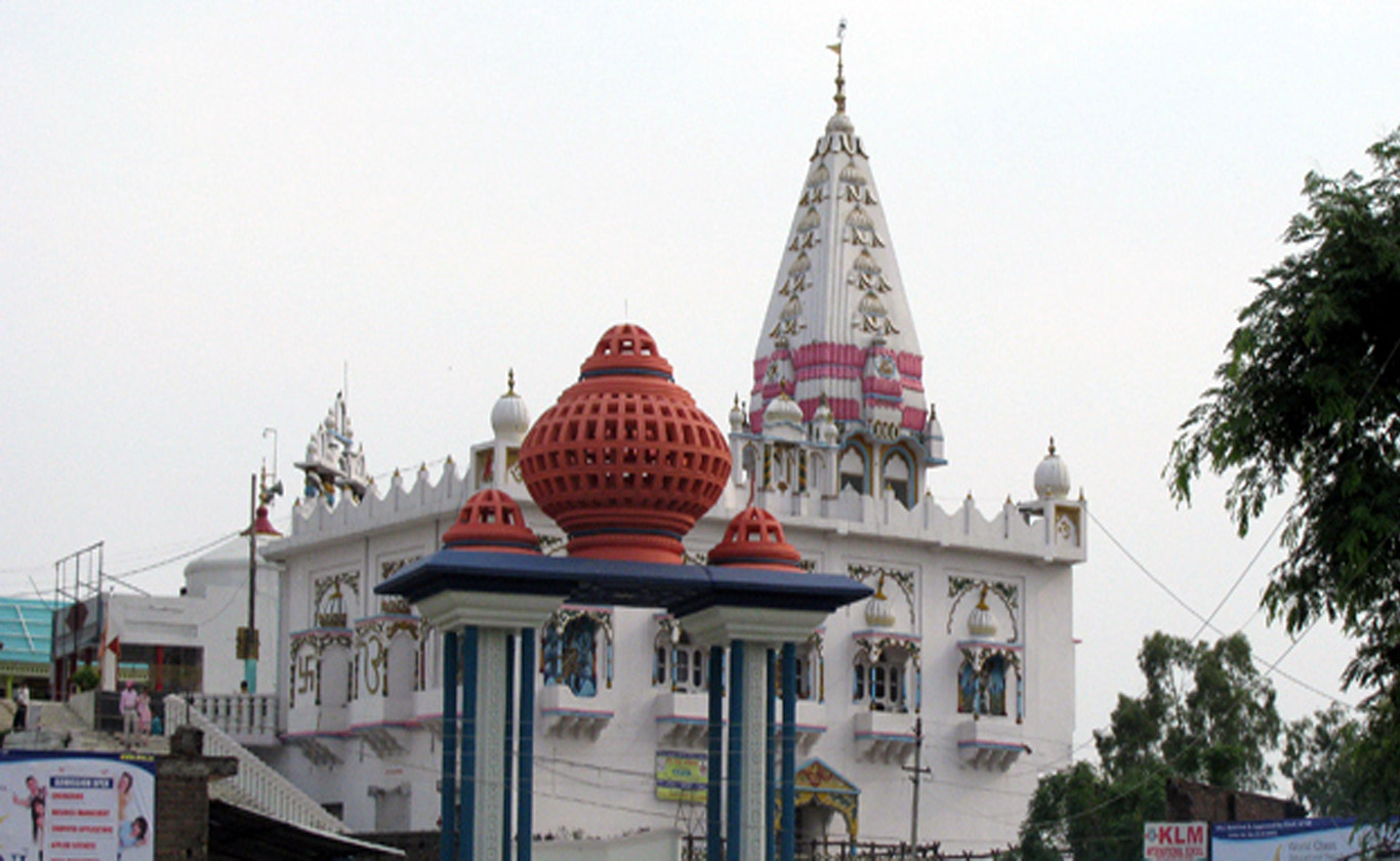
Chintpurni devi temple
Goddess Mata Chintapurni Temple is the famous Hindu Temple in Himachal Pradesh. It is devoted to goddess Mata Chintpurni or Chhinnamastika Devi. The one who helps the sincere and devoted yogi to dissolve his or her mind, including all the predetermined ideas, attachments and habits into the Pure godly Consciousness, is the the headless goddess, Chhinnamasta which having Great Cosmic Power.
One of the 7 major and 51 total Shakti Peethas is Chhinnamasta or Chinnamastika temple. The mythology of Daksha yaga and Sati’s self immolation is the mythology liked to the Shakti Peethas. The other name for goddess Chamunda Devi is Mahakali.
In the opinion of the Hindu mythology, Lord Vishnu cut the skeleton of Shati in to fifty one pieces with his chakra to stop the wrath of lord Shiva. It is believed that the feet of Sati fell in this place where the temple has been built.This Shaktipeeth have been visiting for centuries by devotees to pray at the lotus feet of goddess Mata Chhinnamastika Devi. This temple is revered by the Hindus in Punjab, Haryana and Himachal Pradesh and it is believed that the Goddess Chintapurni is the remover of all troubles.From the goddess Devi, the devotees bring their worldly concerns and seek blessings. It is said that your wish will be granted and fulfilled, if you ask something from the Devi with a true heart.Chintpurni Maa “Chinta” Means”worry”, worries act as a slow poison. Mathaa saves her bhaktas (Devotees)from it, giving tonic of life, by fulfilling their desires and hence rightly known as CHINTAPURNI. The goddess is also known as the home of Chhinnamastila.The devotees bring with them their worldly concerns and seek blessings from the Devi. It is said that if you ask something from the Devi with a true heart, your wish will be granted and fulfilled.
Bir Billing

Billing is renowned the world over for having the distinction for the first Paragliding competition and every year, The Department of Tourism and Civil Aviation, Government of Himachal Pradesh organises the ‘Para Gliding Pre world Cup’ at Billing- Bir in the month of October. It is also ‘the place’ for Hang gliding and Para Sailing.
Bir was ruled by the Pal dynasty of the Chandarvanshi lineage. The last Raja or Rai was Raizada Prithi Pal, who was a descendant of the Rajas of Bhangahal, who appear to have maintained their rights until the time of Raja Prithi Pal in the early part of the eighteenth century. Raja Prithi Pal fell victim to his father-in-law, Raja Sidh Sen, who in 1728 invited him to Mandi on the pretext of seeking his assistance against the Raja of Suket. He was kindly received, but within a month of his arrival he was beguiled into the Damdama Fort, and there murdered. It is said his body was duly burnt, but his head was buried in a tank facing the Mandi Raja’s palace. A pillar was erected on the spot, and a light was kept burning on it for years. Sidh Sen’s object in murdering Raja Prithi Pal was to seize his territory, but in this he only partially succeeded. The forts at Jagapur, Tika Thana and the Patgana of Nir, with eighteen villages of Ilaga Chuhar (all of them until then forming part of the Bhangahal kingdom) were annexed to Mandi. Subsequently, Sidh Sen sttempted to seize Karanpur, which also belonged to Bhangahal, but he was repulsed by Raja Raghunath Pal who had succeeded his father Raja Prithi Pal. In a second invasion, he penetrated as far as Kotharli Gulu, then in Bhangahal, but Raghunath Pal was able, with the assistance of Raja Thedi Singh of Kulu, not only to check his advance, but also to beat him back with considerable loss.
The Mughal Emperors always appreciated the loyalty of the Bhanghal chiefs, and when the news of repeated aggression of the Mandhi Raja on Bhangahal reached the Emperor in Delhi, he deputed Adina Beg, Governor of Jullundur, to drive him off. But the Khan died on the road at Dinanagar in 1732. The affair ended unfortunately for Raghunath Pal, who went to meet the Governor, as Sham Sher Singh, then Raja of Mandi, took advantage of his absence to seize the much-coveted ilaqa of Karanpur.
Raghunath Pal died in 1749, and was succeeded by his son, Dalip Pal, whose reign was rendered memorable by a combined, though unsuccessful, attack made on Bhangahal by the Rajas of Mandi, Kullu, Kahlur, Nalagarh, Guler and Jaswan. The united forces of these chiefs encamped at Tika Changar, and made an attempt to capture the Raja and his brother, Mian Bhim Pal, but were eventually driven back with great loss. the Raja commemorated the victory by erecting several mounds composed of the heads of his slaughtered foes. One of these mounds exists in the pine forest in Bir, and another stands on the banks of river Pun river within the limits of Bhangahal.
Bir taaluqa was annexed in 1779 by the Raja of Kulu shortly before the death of Dalip Pal, whose son, Man pal, succeeded only to the taaluqas of Lanod and Paprola. He died on his way to Delhi, whither he was proceeding with the object of enlisting the sympathies of the Mughal Emperor in an attempt to make the recovery of his patrimony. The Rajas of Kangra and Guler took advantage of Man Pal’s absence to seize villages and lands, Kangra appropriating Lanod and Paprola and Guler the remaining property. Man Pal’s widow and her infant son, Uchal Pal sought refuge at Rehlu with Raja Rai Singh of Chamba, who gave her a home and allowed her a small jagir.
In 1785, when Raja Sansar Chand of Kangra married a daughter of Man Pal, he lent Uchal Pal a small force to help him in recovering his lands from Mandi Raja. This latter Chief had recourse to stratagem. He bought off Sansar Chand’s principal officer and persuaded Raja Rai Singh of Chamba to carry war into Katoch dominions. When Sansar Chand found that Rai singh had advanced within a short distance of Kangra, he had to muster all his available forces, including the portion he had lent to Uchal Pal. After the battle of Nerti, in which Raja Rai Singh was defeated and killed, the Mandi and Kullu Rajas secured the possession of Bangahal by paying Sansar Chand five lakh rupees (INR 500,000).
Some time after this Uchal pal died, leaving three sons and a daughter, who lived under – Raja Sansar chand katoch protection. The girl subsequently married the Raja of Siba. Ram Pal, the eldest son of Uchal Pal died childless in 1843. The efforts of Bahadur Pal, his younger brother, to recover the family estate, were always opposed by the Raja of Mandi. Mathru, the father or Barar Pal, the head of the family in 1909, succeeded in obtaining from the British Government a pension of Rs. 500 per annum for his cousin, Mian Bahadur Pal, and this he enjoyed until his death in 1854. Barar Pal was given the title of Rai Sahib in 1895. he was a Divisional Darbari,Lambardar and Kotwal of his circle and a member of the Local and District Boards. His family held 80 acres as proprietors in Bir Bhangahal and Bir, yielding Rs. 2,200 per annum. He died in 1912. The last Head, Mian Prithi Pal, was a Zaildar and lived in Bir. He was very well spoken of by his people
Garli
Garli is a heritage village located in Kangra District of Himachal Pradesh. Garli is said to be sister of Pragpur. Beas River flows close by. The wealth of the village can be seen in the grand but now deserted buildings that adorn the streets of Garli. In Garli, the Sood Community has built elegant havelis, mansions and Italianate buildings, which are interspersed amongst lovely mud-plastered and slate-roofed houses. These buildings lie alongside streets paved with dressed cobbled stone. Some of the prominent buildings are Bhagwan Niwas and UCO Bank Building.
Garli , Kangra, HimachalThe Government of Himachal Pradesh declared the Garli-Pragpur area as a Heritage Zone in 2002, to protect the heritage of garli. The ambience of this area is protected by the local residents. In their endeavour that Garli – Pragpur retains its unique character, panchayats preserve their heritage buildings and advise on new construction. Several heritage structures are now being restored using original techniques but with modern facilities to facilitate tourism.
Haripur

Haripur is 55 km from Dharamsala via Ranital. An isolated place with a Rest House on one corner of a big, open ground. A small bazaar fulfils the daily requirements.
Haripur is a small town in Kangra district of Himachal Pradesh. Haripur Guler are twin townships carrying the heritage of Guler Riyasat. Haripur is on the Nurpur-Jwalamukhi road, between Nagrota Suriyan and Balta in Kangra District. It is nearly 8 km east of Mangwal, 18 km south of Yol and 4 km north of Balta. Founded in 1464, Haripur is a historic place where the famous Kangra miniature paintings (Pahari Paintings) were born. The town was famed as the cradle of the Kangra School of Paintings, which came to a decline at the close of the 19th century. The ancient fort and water springs at Haripur are worth a visit. This was the capital of the princely state of Haripur Guler – an offshoot of Kangra. Legend has it that Raja Hari Chand of Kangra became disengaged from his companions on a hunting expedition and fell into a well. After a long search, the hunting party gave him up for dead and returned to Kangra where his wives became satis, burning themselves on the funeral pyre, and his younger brother, Karan Chand was placed on the throne. After 22 days of being trapped in the well, Hari Chand was rescued by a passing merchant. Rather than struggle to regain his kingdom, Hari Chand set up his own kingdom based at what he named ‘Haripur’ after himself.
Haripur Fort in Kangra, HimachalHaripur fort has been ravaged by time and is not as well known or as large as the Kangra fort but it is strategically built. The location is picturesque and the Banganga rivulet gives it natural protection. Inside, there are a few carvings but they are blurred and difficult to reach – though 18th century travellers who visited the fort recorded that the Guler palace of Haripur fort had exquisite paintings and carvings. A major school of miniature paintings was also based here. After the construction of the Pong Dam and the flooding of the area by the waters of the Maharana Pratap Sagar, many people in Haripur had their lands submerged. Haripur yet holds several old temples and remarkable city gates with large stone carvings of deities from the Hindu pantheon that testify to a long gone creative impulse.
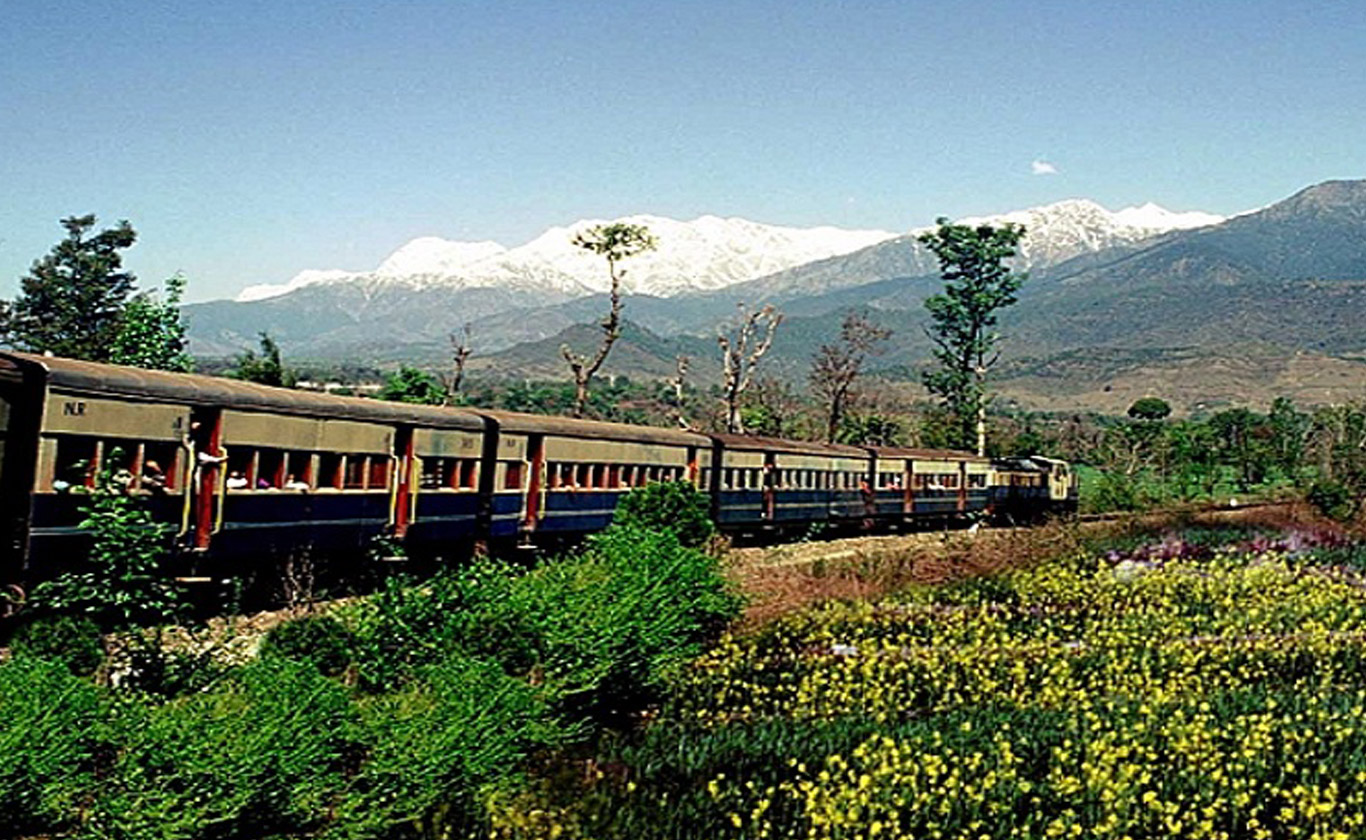
This is still an important station on the narrow-gauge Kangra Valley Railway which connects the broad-gauge station of Pathankot with the town of Jogindernagar – and is one of the most interesting ways of travelling though the countryside as the line is believed to have been built in a manner that did not spoil the area and could maximise the views of the valleys and hills for travellers!
Dehra
It is 55 km from Dharmasala. It is a sub divisional headquarters and sitting in the Rest House one enjoys the beauty of sun set reflecting ithe last rays on the waters of river Beas.
Dehra in Kangra district, HimachalDehra was a town of British India, currently a tehsil in Kangra district of Himachal Pradesh of India. The River Beas divides the town into Dehra & Gopipur. Dehra is the oldest of Tehsil in Kangra of Himachal Pradesh. It is situated on the bank of the Beas. It is possible to use Dehra as a base for different fishing areas like Pong Dam, Pattan, kurn and Nadaun. They are Easiy accessible from here. There are PWD and Forest rest houses for a night stay . One can also visit the famous temple of Chintpurni from here. Jwalamukhi Temple, one of the Shaktipithas, is a prominent shrine, which is visited by devotees.
As the town is fusion of two words Dehra & Gopipur both have a reason for the same. Gopipur is attached with history from the times of Mahabharta. According to the legend when Kalyavana demon was running behind lord Krishna lord disappeared in some caves in the Gopipur foothills & killed the demon inside the caves. An ancient Pandav temple is the oldest temple in the town aging from the time of Mahabharata. The town of Dehra is as recent as mid 15th century when foreign invaders used this place as a DERA (camp) for their expedition to hill states. British made the evolving town as the tehsil in year 1868.


Leave A Comment